163-G 1.1
GNSS-based remote sensing: Innovative observation of key hydrological parameters in the central Andes
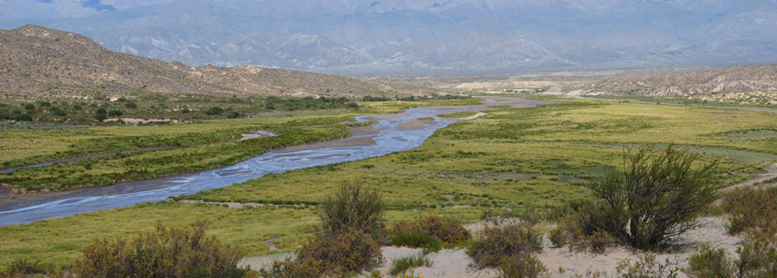
The central Andes are characterized by a steep climatic gradient where key hydrologic variables change across short distances. One of the largest unknown component in this environment is the storage of water in the atmosphere, soil (soil moisture) and the snow height (or snow water equivalent). Both are parameters that can be quantified with modern remote sensing technology and we seek to enhance our understanding of the complete water fluxes in this environment – especially the highly dynamic fluxes that are often associated with hydrometerological extreme events.
In the past two decades, innovative GNSS (Global Navigational Satellite Systems) based remote sensing techniques were successfully tested and established and the resulting observations evolved into an important data source for numerous meteorological applications. The most prominent example for this development is the operational use of GNSS-based temperature and water vapor data to improve day-by-day regional and global weather forecasts since 2006. The exploitation of Earth reflected signals (GNSS Reflectometry, GNSS-R), however is not yet operationally applied and still focus of international research to reach operational application level as well. GNSS data provide an excellent opportunity to study the dynamics of hydrometeorological extreme events, because of the very high sampling interval.
This project relies on close collaboration with Argentinean researchers that maintain a regional GNSS ground network. In the framework of this project, new stations at specific, key locations will be installed and the data used to decipher hydrologic process. This project requires strong quantitative skills and thorough environmental knowledge.
Characterization of atmospheric processes related to hydro-meteorological extreme events over the south-central Andes
Extreme rainfall events fundamentally impact erosion and deposition. The combination of the South American Monsoon System (SAMS) and high topography of the Central Andes constitutes the most important drivers for the highly asymmetric distribution of rainfall. In light of these conditions and climate variability involving the SAMS, the South American Convergence Zone, the El Niño Southern Oscillation, and the Southern Hemisphere Westerlies, meteorological observations and detailed analysis of the atmospheric circulation over South America at various spatiotemporal scales are required to create models and derive predictions of the response of surface-process systems to climate change. For more than a decade, the GPS radio occultation (RO) method has offered a promising tool for the global characterization of atmospheric temperature and tropospheric humidity. Here, we will use ground (weather stations, radiosonde stations, and S band radar stations) and space-based (RO and other satellites) observations and meteorological re-analyses (ERA interim, ERA40) to obtain a detailed view of the dynamics of the SAMS, the related humidity fields, and precipitation patterns. In addition, this approach will help to decipher the characteristics of annual and seasonal variability, and the linkage to extreme precipitation events. The considered time scale will range from the time since RO observations are available (since 2001) and extend to the beginning of the ERA40 dataset covering the 1950s. Finally, we will associate the combined observational and re-analysis data with their spatiotemporal variation to QBO and ENSO events for a better understanding of the interplay between natural atmospheric variability and the observed humidity/rainfall amount and distribution. Due to a recent southward shift of the SAMS and an amplification of the jet stream, coupled with increased southward moisture transport from Amazonia and annual precipitation, it can be expected that variations in atmosphere dynamics, tropopause structure, and gravity-wave activity will occur, an issue that will also be addressed in this study. Combined, the results of this project will be essential to understanding regional erosional and sedimentological processes on short timescales, and will help clarify the couplings between climate and surface-process reflected in geological archives of intermontane and foreland basin fills.