163-G 2.1
Quaternary landscape evolution Paleoseismology and active tectonics of the NW-Argentineian broken foreland under the influence of tectonic processes.
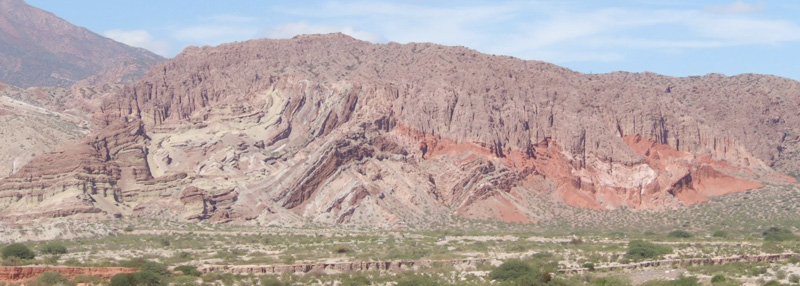
Fault systems in the broken foreland of NW Argentina are associated with isolated seismicity, deformation, and uplift, and they pose a major problem in understanding the spatiotemporal characteristics of individual earthquakes and long-term deformation patterns. Range uplift in these environments is highly disparate in time and space, without a clear deformation front as in the foreland fold-and-thrust belt to the north. Some ranges constitute large anticlines that have formed over blind thrusts, such as the growing anticlines west of the town of Salta.
On geological time scales, the erratic tectonic behavior of fault-bounded intermontane basins has caused a disturbance of the fluvial systems and resulted in multiple episodes of basin filling and sediment removal to the foreland. Importantly, there appears to be a relationship between sediment removal and ensuing changes in crustal stresses in these environments. For example, fault reactivation within and along basin margins is observed to follow the removal of the sedimentary load on time scales of several 105 years.
To elucidate the mechanisms by which such fault arrays in broken forelands organize, activate, and deactivate over time, we will compare geomorphic and geologic records that integrate the activity of faults over multithousand-year timescales (i.e., by dating deformed geomorphic features such as fans and terraces using U/Pb dating) to million-year timescales (i.e., by applying geochronologic and thermochronologic methods). These types of observations will enable the determination of the spatiotemporal faulting history and help to assess how deformation may be transferred between fault fault systems over long timescales (PhD1). We will furthermore use the Gale geodynamic model 87 to study how topographic construction and changing constitutive properties of fault zones may moderate the transfer of deformation between such arrays (PhD2).
As deformation accrues and mountain ranges are built, body forces in the crust may cause one set of structures to become less susceptible to failure relative to surrounding structures. Deformation may then systematically migrate from areas of higher to lower elevations. However, coeval erosional processes export mass from the basins and ranges, and so may buffer the accumulation of body forces in the crust. Gale allows application of surface-processes rules, enabling us to couple erosion at the surface to changes in the deformation field within the upper crust. Combining field observations, geochronology and modeling is expected to help us ascertain plausible causal mechanisms of spatiotemporal patterns of deformation.
Spatiotemporal characteristics of paleo-, historic and recent earthquakes in the broken foreland of the south-central Andes
In this project we will investigate large and medium-magnitude earthquakes using waveform analysis of historical and modern seismograms for event location, magnitude, and depth as well as focal mechanisms and source-time function. Historical earthquakes recorded at analog stations worldwide (primarily recorded on paper or film) since the beginning of the last century can be digitized and analyzed with advanced methods to better constrain their characteristics. For example, using waveform inversion, we are able to derive depth, lateral extent, and the true fault plane as well as zones of increased slip along rupture planes. With such a data set, we aim to identify and quantify the related earthquake surface-rupture trace or remnants of earlier surface ruptures in the epicentral regions. High-resolution satellite imagery, aerial photography, cosmogenic nuclide exposure dating of offset geomorphic markers, fault scarp measurements, and fault trenching will complement this analysis and provide an unprecedented data set to assess earthquake characteristics. We will focus on the large magnitude, shallow crustal seismic events in the region in the Andean foreland, e.g., the 1894 (M8), 1908 (M6.8), 1929 (M6.5), 1944 (M7.8), 1952 (M7.0) and 1977 (M7.4) events. Depending on the quality of historic records and local conditions, we will select two sites (preferably the 1894 and 1952/1977 San Juan events). For these sites, we will relocate medium-size earthquakes, determine their seismic moment tensors (focal mechanisms) and depth from waveform inversion and thereby test possible relationships between recent seismic activity and surficial deformation characteristics. Deployment of temporary seismic stations in addition to existing permanent stations at one or two selected sites will help identify active structures from small magnitude events. We will reevaluate seismic-moment tensors for the foreland region for recent events, where the magnitude threshold depends on data availability. Taken together, the results will provide better insight into the relationships between aseismic and seismic deformation, the identification of active structures, and possible changes in the spatiotemporal deformation characteristics of important structures. Such knowledge will ultimately shed light on the dynamics of Quaternary tectonic activity compared to the overall tectonic and topographic evolution of ranges in the broken foreland and help elucidate the background sedimentation rates and patterns in light of tectonic forcing mechanisms.